Hong Kong Heat Wave Breaks Records Before Weekend Relief
Bastillepost · 1 SOURCESabout 1 hour ago2 MIN
Summary
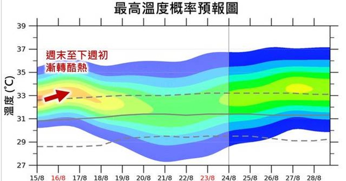
The Hong Kong Observatory's latest "Weather Diary" reveals that Hong Kong experienced an extended period of extreme heat due to the outer descending airflow and southwest currents associated with Typhoon Dolphin, leading to the breaking of multiple temperature-related records . A strong thunderstorm band brought significant rainfall on Friday morning, August 14, prompting the issuance of a Yellow Rainstorm Warning at 8:40 AM, with special alerts for Lamma Island and Po Toi where rainfall was particularly intense . While temperatures will briefly moderate, the Observatory forecasts a return to scorching conditions from the weekend through early next week . meteorologists are also tracking a broad low-pressure trough that may generate tropical disturbances in the northern South China Sea, though forecast models remain divided on development scenarios .
Key Points
- The Yellow Rainstorm Warning was issued at 8:40 AM on August 14, with localized heavy rain alerts for Lamma Island and Po Toi
- Most areas recorded over 30mm of rainfall, while southern islands received more than 70mm during the morning thunderstorm
- A strong thunderstorm band brought heavy showers and gusty thunderstorms across the territory on Friday morning
- The Observatory warns that heat will intensify again as the southwest airflow strengthens through the weekend into early next week
- Forecast models disagree on whether low-pressure systems will develop in the South China Sea, which could affect rain and wind patterns mid-to-late next week
Why It Matters
The pattern of record-breaking heat followed by intense thunderstorms reflects the volatile atmospheric conditions that Hong Kong faces during the summer typhoon season. For residents, this means staying vigilant about both heatstroke risks during the anticipated return to extreme heat and potential flooding from sudden thunderstorms. The uncertain development of tropical disturbances in the South China Sea could further complicate weather patterns next week, making it essential for the public to monitor official forecasts closely.
The pattern of record-breaking heat followed by intense thunderstorms reflects the volatile atmospheric conditions that Hong Kong faces during the summer typhoon season. For residents, this means staying vigilant about both heatstroke risks during the anticipated return to extreme heat and potential flooding from sudden thunderstorms. The uncertain development of tropical disturbances in the South China Sea could further complicate weather patterns next week, making it essential for the public to monitor official forecasts closely.