Observatory Warns of Showers, Gusty Winds and Thunderstorms Through Tuesday
HK01 · 1 SOURCESabout 1 hour ago4 MIN
Summary
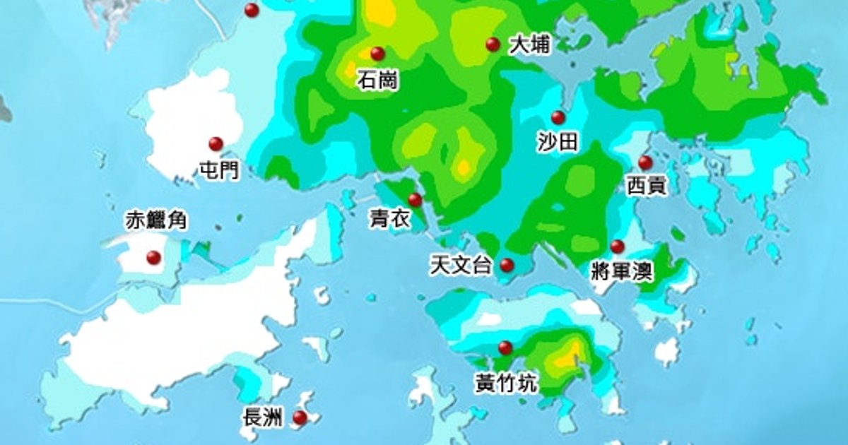
The Hong Kong Observatory has issued a nine-day weather forecast predicting persistent unstable conditions across the territory. Starting Tuesday, August 18, Hong Kong will experience intermittent showers, gusty winds and thunderstorms, with heavy rainfall expected in some districts initially. High temperature-triggered thunderstorm activity has already begun affecting the region, with Monday recording over 30mm of rainfall in certain areas before noon.
Key Points
- Tuesday, August 18: Some showers and gusty thunderstorms expected; heavy rainfall in some districts initially
- Wednesday through Sunday: Persistent showers and thunderstorms with gusty winds; heavy rain in parts on Friday
- Monday, August 17: Special weather alert issued warning of heavy rain affecting widespread areas within 1-2 hours
- Noon Monday: Observatory recorded over 30mm of rainfall in parts of Hong Kong before afternoon
- Guangdong region experiencing light winds and very hot conditions; high temperatures triggering thunderstorm activity
- Current conditions: Mostly cloudy with showers and thunderstorms; brief sunny periods with very hot temperatures
Why It Matters
The prolonged period of unstable weather follows the recent issuance of an 8号风球 (Typhoon Signal No. 8) on July 26, 2026, highlighting Hong Kong's vulnerability to severe weather events during the summer months. Residents should remain vigilant and take precautions against sudden flooding and wind hazards, particularly during thunderstorm activity .
The prolonged period of unstable weather follows the recent issuance of an 8号风球 (Typhoon Signal No. 8) on July 26, 2026, highlighting Hong Kong's vulnerability to severe weather events during the summer months. Residents should remain vigilant and take precautions against sudden flooding and wind hazards, particularly during thunderstorm activity .