Tropical Depression Forms Near Hong Kong, Typhoon Dolphin Threatens East China
HK01 · 1 SOURCESabout 1 hour ago2 MIN
Summary
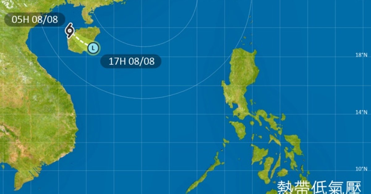
A tropical depression formed in the Beibu Gulf early today, positioned about 160 kilometers west of Haikou, and is forecast to weaken into a low pressure area after crossing Hainan Island. The Hong Kong Observatory indicated it would only issue a Standby Signal No. 1 if the system intensifies and comes within 800 kilometers of Hong Kong. Separately, Super Typhoon Dolphin continues toward eastern China, with its outer subsiding airflow causing extreme heat in Hong Kong with temperatures reaching 35°C in urban areas and 37°C or above in some districts .
Key Points
- The tropical depression was located approximately 160 kilometers west of Haikou at 5 a.m., moving southeast at 15 kilometers per hour .
- The system is expected to make landfall on Hainan Island and weaken into a low pressure area near Wanning by 5 p.m. today, with maximum sustained winds of 40 km/h .
- Super Typhoon Dolphin was positioned about 130 kilometers northwest of Okinawa at 5 a.m., moving west at 10 km/h across the East China Sea .
- Dolphin is forecast to make landfall near Wenzhou, approximately 1,000 kilometers northeast of Hong Kong, as a super typhoon with 165 km/h winds early Sunday .
- The Observatory's nine-day forecast shows extreme heat continuing through Monday, with isolated showers and thunderstorms from tomorrow through next Sunday .
Why It Matters
The concurrent weather systems highlight Hong Kong's vulnerability to multiple tropical threats during peak typhoon season, while extreme heat warnings remain critical for public health planning through early next week .
The concurrent weather systems highlight Hong Kong's vulnerability to multiple tropical threats during peak typhoon season, while extreme heat warnings remain critical for public health planning through early next week .